
Our services

Utility Locating
Utility location is the process of identifying and labelling public and private utility mains underground. Existing maps and drawings are not always reliable, and we often find old, abandoned or even new underground facilities that are not noted on any existing property map. Whether planning for an environmental drilling project, or installing a new conduit trench, we can provide you with an accurate, reliable and complete utility locate of your site or property using a mixture of non-destructive locating technologies like Electromagnetic Locators and Ground Penetrating Radar.
-
Utility Locating is like completing a puzzle and a scavenger hunt at the same time. By utilizing multiple technologies and techniques we can complete an accurate subsurface picture of the infrastructure that makes up public and private underground facilities. Our locators primarily rely on two non-destructive methodologies to complete a thorough locate: Electromagnetic locators and Ground Penetrating Radar.
When called to a site we often find that existing maps are not a full record of subsurface infrastructure. As buildings get upgrades and drawings get lost from previous builds, over time maps can be incomplete, inaccurate, and sometimes even non-existent.
It is important for building owners and contractors to complete their due diligence when it comes to utility infrastructure and making changes to a site. If you’re planning for anything from a home renovation, environmental drilling project, or a construction build, to a simple install of a new conduit trench, we can provide you with an accurate, reliable and complete utility locate of your site or property.
Once our technician completes their, locate you will be provided with a digital locate report before we’ve even left site, including of all our findings. No need to wait for an overdrawn and over-engineered report that increases the cost of your project. We’ll have a report for you immediately, with all the information and detail you’ll need to complete your job safely.

Surveying with GPS and Total Station
Once underground facilities are located, we can provide an accurate survey-grade map of a site or property using GPS-RTK, Robotic Total Station or Laser Scanning. We will work with you to capture any further details you need, such as a topographic survey, power line survey, or important building features. All the data is provided in a CAD format including the processed data and information in an engineered report.

3D Laser Scanning
With state of the art High Speed Laser Scanning you can get precision accuracy due to millions of data points captured to create an extremely accurate scan and survey of a complex site or building. Quadra utilizes the Trimble X7 3D Laser Scanning System Use the data for fast surveying, site visualizations or accurate measurements where conventional survey methods may be too time consuming or inefficient. We can capture even the most complex of geometry quickly.
The laser scanner outputs these points of data into a visual ‘point cloud’ where they are measured and plotted into traditional CAD drawings and documents or as visual point clouds for other 3D applications.

Oil and Gas Pipeline Projects
We have considerable experience working with oil & gas pipeline companies across British Columbia in urban and remote areas. Our trained, certified, and experienced locators provide a range of services from site inspection and monitoring to right-of-way sweeping and route planning.
Trusted by companies such as TransMountain, Suncor, and Enbridge, we have a wealth of knowledge and experience to complete any project.

Concrete Scanning
Concrete scanning (concrete imaging) provides detailed imagery of rebar, conduits and post-tension cable lines. Our high-frequency concrete scanning GPR and Ferroscan tools can help you find lines and conduits and rebar buried in concrete slabs at new construction sites or older slabs.
Concrete scanning can be used for many reasons, such as determining the best point for the installation of soil-vapour probes, concrete coring, rebar mapping a slab, finding conduits within a concrete pour or the location of post-tension cables.

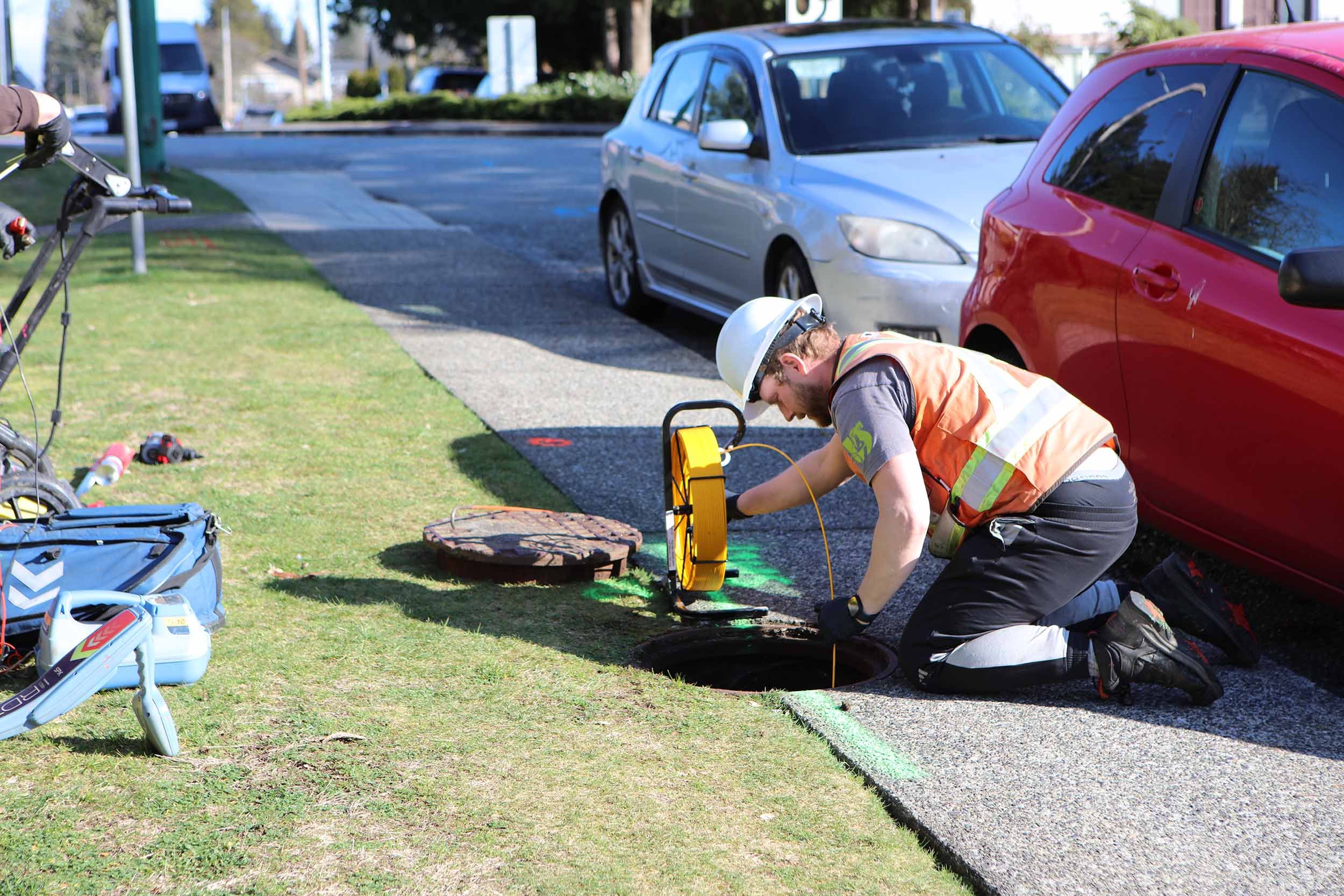
Camera Pipe Inspection
Camera Pipe inspections are becoming more frequently required by municipalities and contractors, Pre and Post constructions.
If you have a project that needs video inspection, we can help you get eyes in tight spaces. Whether you have a pipe blockage or need to evaluate the integrity of your drainage pipes in a new warehouse build, or are looking for inspection of manhole chambers, vaults, or subsurface voids, we can inspect it and provide high-quality video footage.

Oil Tank Locating
From Underground Storage Tanks ( like residential heating oil tanks and gas station gasoline/diesel tanks, to buried debris at a dumpsite, we can locate any form of buried tank or other object using Electromagnetic Locators and Ground Penetrating Radar. .
For real estate sales, we can provide a report of our findings to aid in the sale or purchase of a home or property.